

cool maps #7
Shanghai Rail System, AMAP vs Google Maps, Shibati, and the expansion of Collective Atlas

i am, 3 months behind on my cool maps commitment, and will leave no excuses to apologize for my MIA-ness.
i seem to have convinced myself that i function best when jumping around, but this month’s non-stop buzz of being plugged in might be finally forcing me to succumb to letting go of a plan or two.
i'm committing to doing nothing in June.
3 inspirations
Shanghai Rail Transit Map
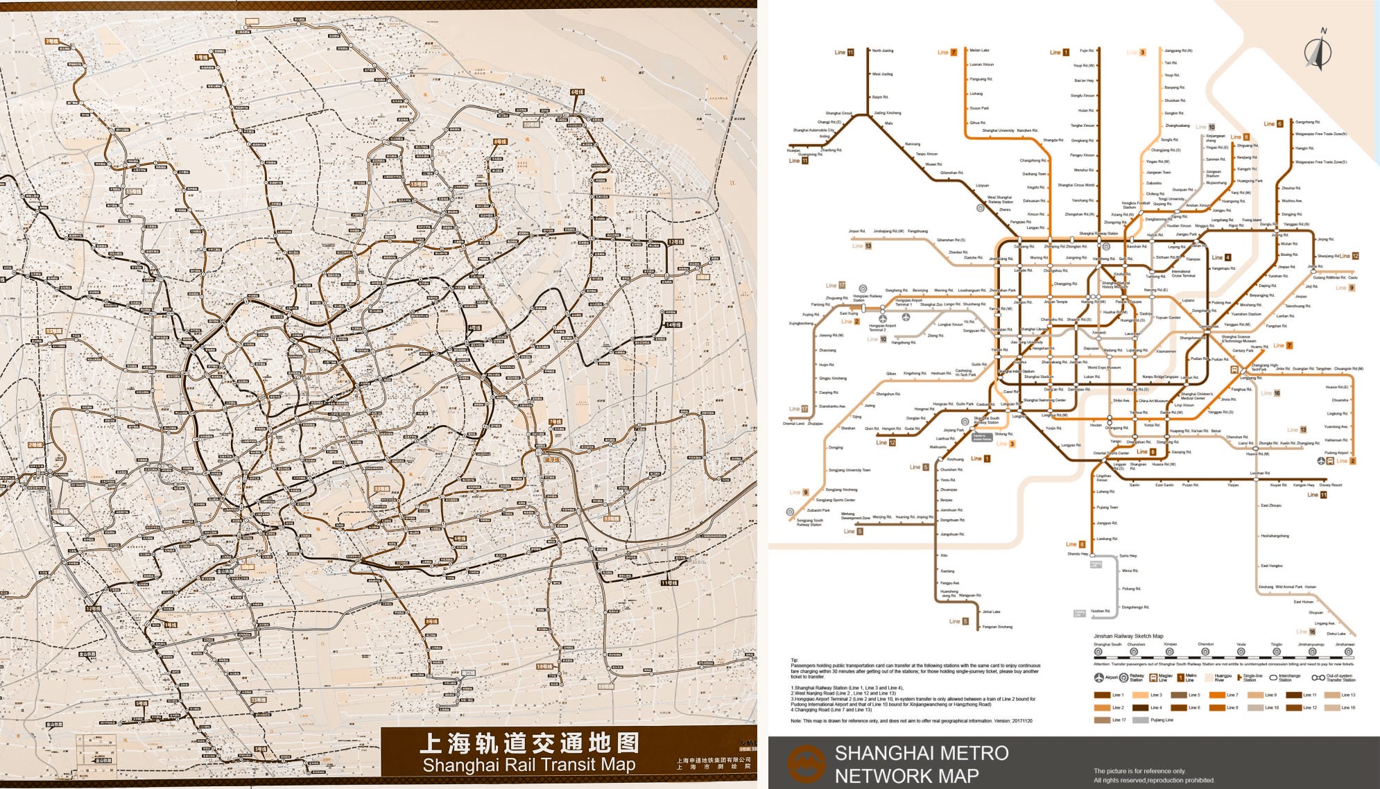
i went to china back in april & may. it was great to get to see family again, spend time with my grandma, cousins, parents, revisit places i frequented as a kid, and re-memorize the transit map again.
i love seeing the geographic and abstracted maps next to each other everywhere i go, and especially so in a city i love so much.
this also got me thinking of the recent MTA transit map redesign last month (which deserves its own spot in cool maps). when it comes to abstraction, Shanghai’s system this isn’t nearly as complex in how the multiple trains run along the same lines. transit planning wise, it’s also more of a decentralized anatomy, and makes the NYC train system look like a hub-and-spoke model in comparison.
AMAP (Alibaba Map)

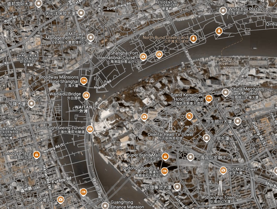
for those two weeks, I also got friendly with AMAP, China’s leading digital map app. comparing to my most used map apps in the US & Canada, it’s immensely information dense, even on my iPhone mini. its list of integrations are also impressive: ride hailing, tickets, influencer content - you even can see housing prices & trends when clicking into an apartment complex.
aside from China’s infamous data compliance and censorship laws, the map apps commonly used in the US have another discrepancy with geographic data in China. maps in China use the GCJ-02 mapping system, which offsets latitude and longitude by 300-500m from the standard WGS 84 geodetic system, as a measure of national security.
some companies comply to this (such as Apple), but in others, this offset can be seen clearly when zooming into cities in China, for example, on Google Maps, where streets and landmarks are shifted from its georectified satellite imagery:
Qing Dynasty map of Shibati, Chongqing
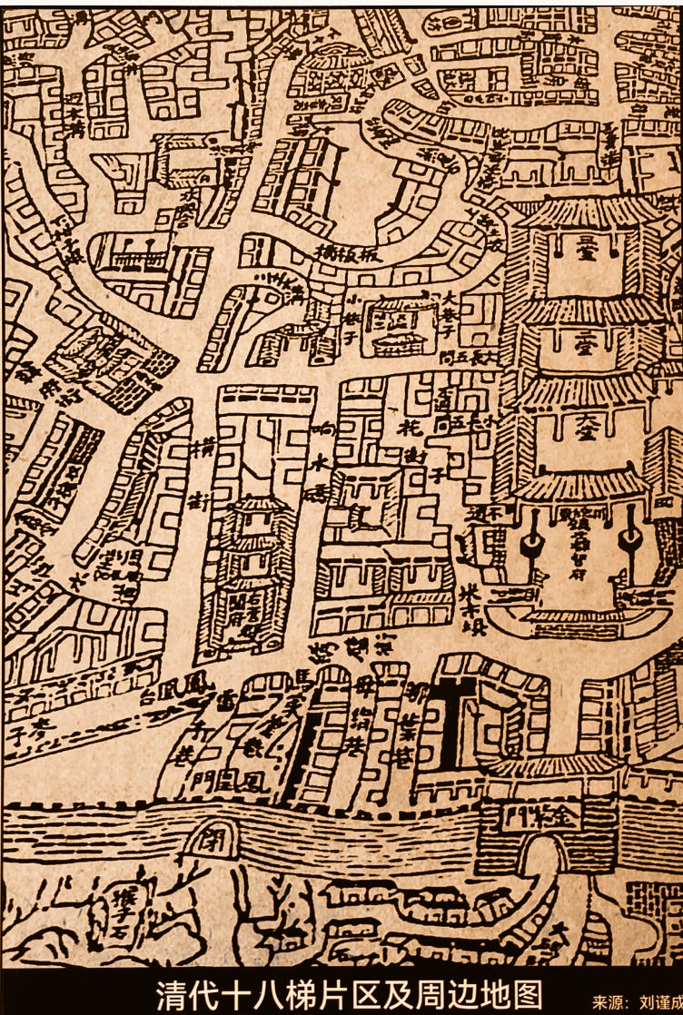
i also got to visit Chongqing briefly with my parents. it’s a very popular domestic destination right now, with amazing food at every elevation. we visited a historic area called shibati (eighteen steps), known for its winding staircases and houses perched on a hill.
one map in its welcome center caught my eye: a drawn map form the Qing Dynasty. its attempt at conveying elevation through depth, and its mix of perspectives, from street view to birds eye view. reminds me of one of my favourite substack posts by Elan Ullendorf, where he touches on examples of how maps were made before standards in geographic visualization.
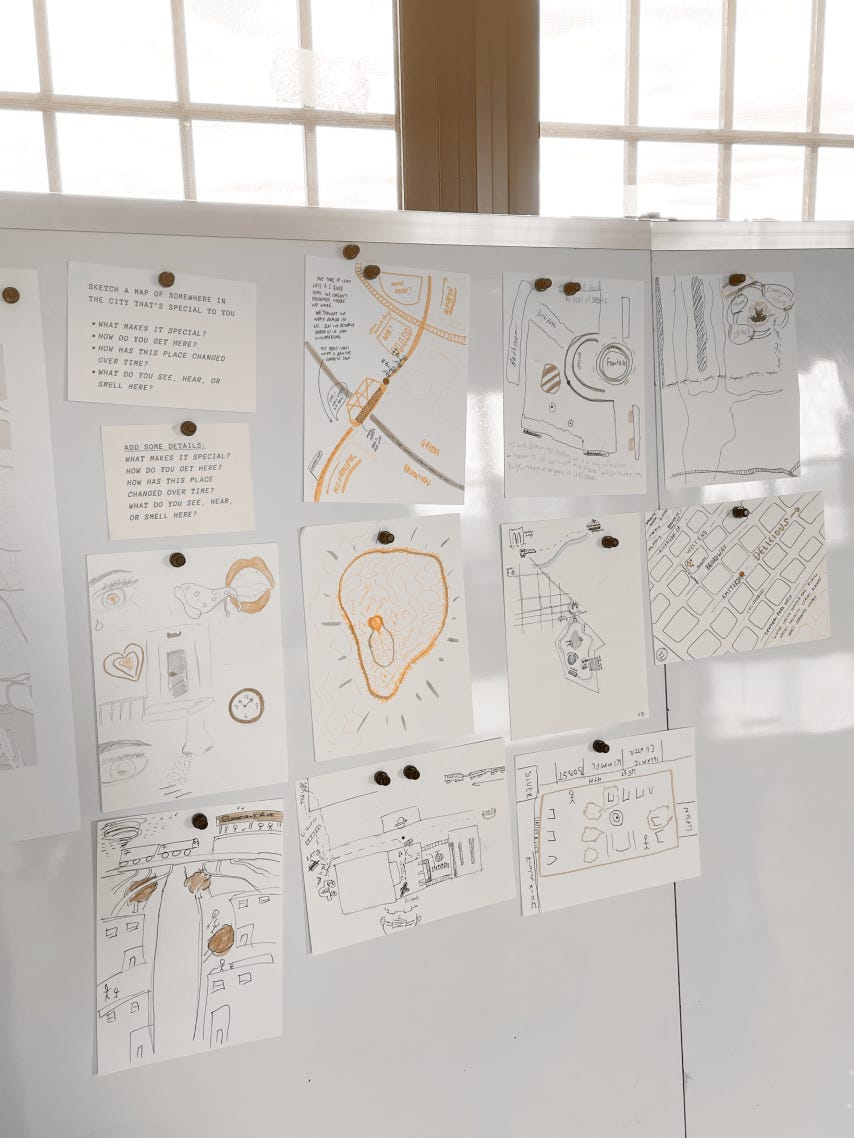
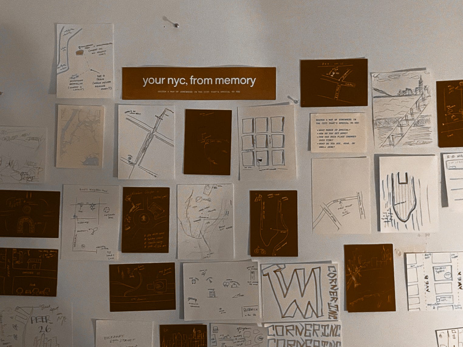
i always find these drawn maps fascinating, as they’re better representations of our spatial memories than any satellite imagery map. capturing these representations, and its differences to objective space, are what i’m most curious about in my Collective Atlas workshops.
1 work in progress
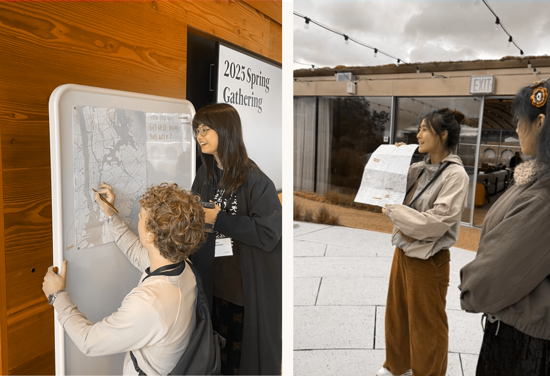
Collective Atlas Workshops
for the past new months, i’ve been running these spatial memory & mapping workshops across a few places. focusing on documenting, sharing, and envisioning a home or routine for it in the future.
i’ve also taken to expanding, modifying and adapting the sessions, to events like the Steve Job Archive’s spring fellowship gathering, Corner.inc’s launch party, and work in progress’s Echoes showcase. some called for more involved artifacts that i used
my hope is that these sessions can remind people that maps can be made by anyone, and they can be used to not only document or navigate, but they’re also tools for storytelling and speculating the best versions of places we love (and will love soon).

i also swear each post is getting longer and longer. do we like that?

more is more :)