


with 15 minutes to spare and one foot out the door en route to a girls’ trip in greece (ahhh!), i realized i had this draft lined up. i’m excited to unplug and actually have a reason for why i’m terrible at responding to texts and emails, but this email can’t fall victim to that tardiness so soon.
this month brought up more inspiration than can be fit into this template, which means you should be very excited for november’s edition :)
3 inspirations
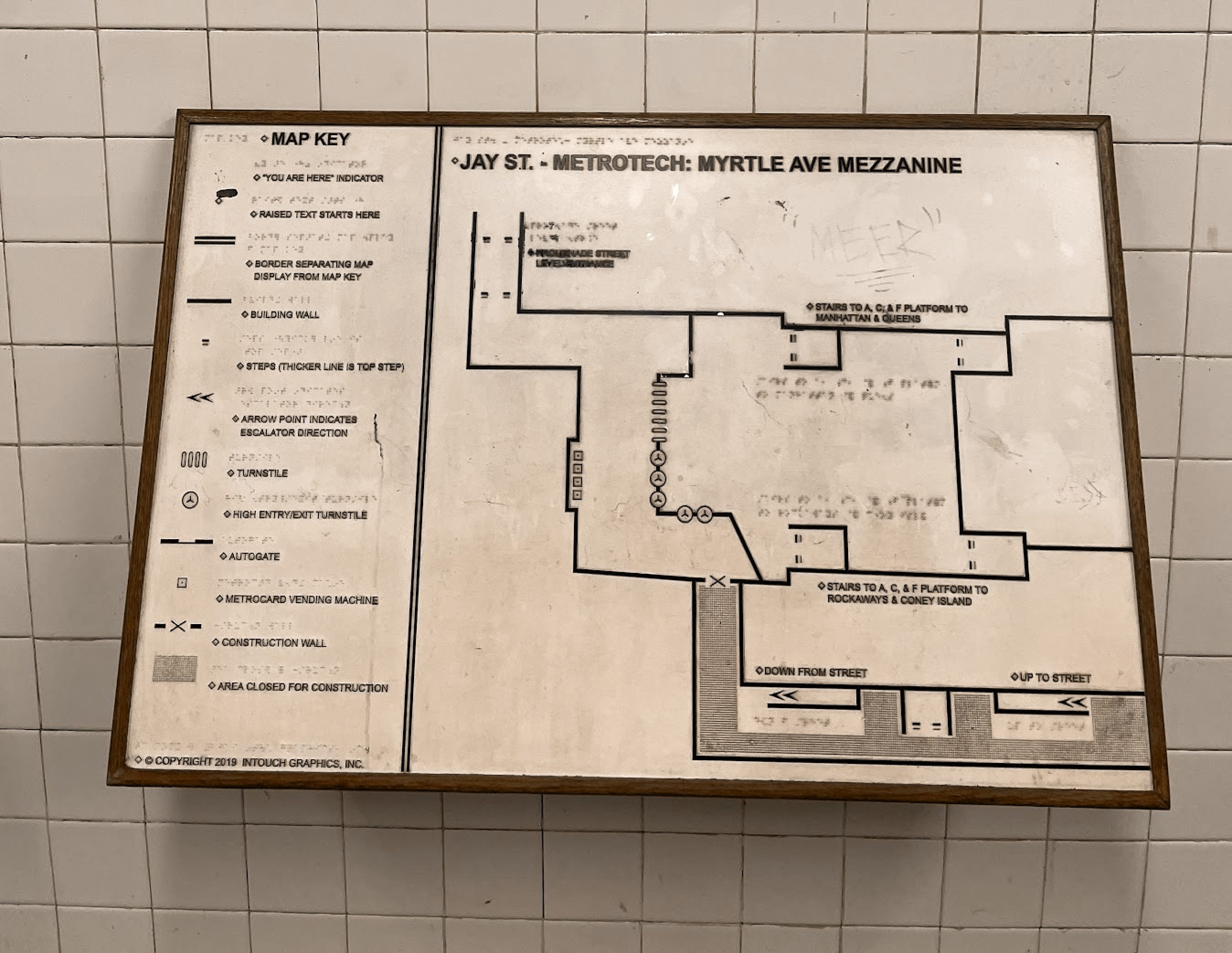
Jay St. Mezzanine Tactile Map
this june, i had the privilege to attend ITP Camp at NYU, a summer camp for adults interested in tinkering. (i highly recommend it if you’re considering!)
one evening, after an evening bite with new friends, i entered the jay street metrotech station from the opposite side i usually do, and stumbled upon this 3d map of the station. i touched it (and then quickly sanitized my hands).
looking into the company that makes these tactile maps, it got me thinking a lot more closely about wayfinding for people with disabilities and impairments. what are some forms of navigation we rarely consider? and what are some ways we can actually make wayfinding more accessible?
Your Name in Landsat
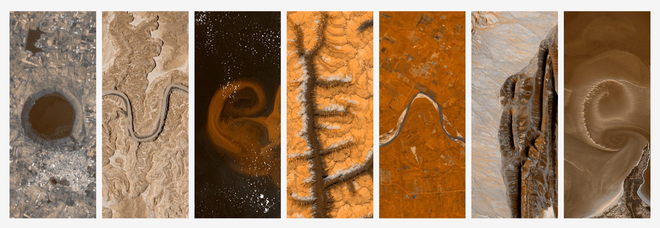
this single-function site full of NASA’s landsat imagery really struck me as something small, fun, and whimsical, especially coming from NASA themselves. it’s beautiful to see the way rivers always curve in “u”s, “s”s, and “n”s, or the series of craters that pop up with “o”s and “q”s.
we as people love finding patterns in everyday things, especially faces. and finding romanized letters in nature a tangential example of that.
Yumi Janairo Roth’s Meta Mapa (2007)
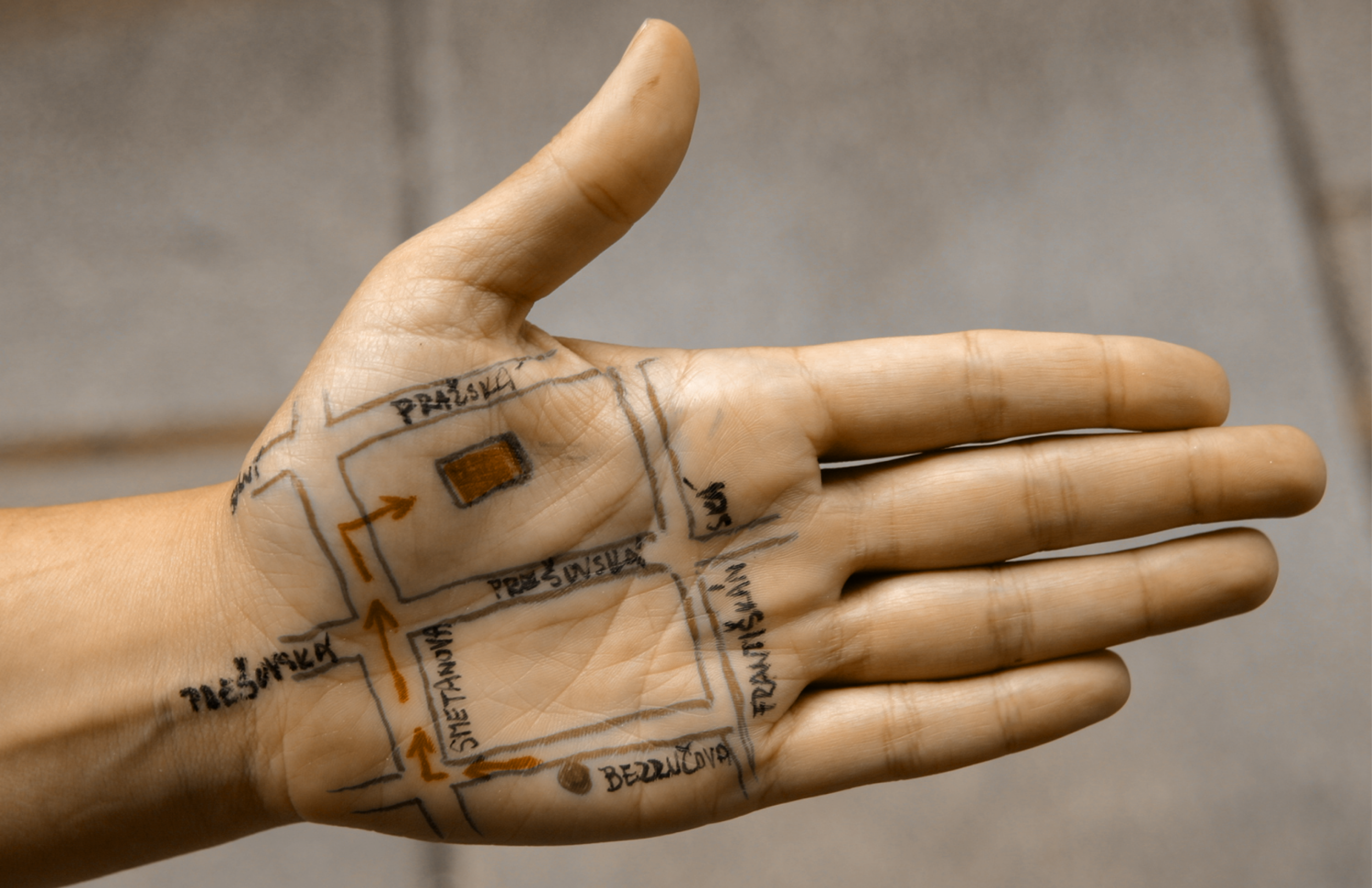
i first discovered Yumi’s work in last year a book called “maps as art” in that cozy bookstore in the Mission in San Francisco. it turned a 2 minute stroll by into a 40 minute one.
Yumi asked residents of Pilsen to draw maps on the facilitators’ hands that detailed routes to different points of interests. these were photographed, and convered into folded paper maps where they asked passer-bys to use and help orient the group. this performance piece really resonated with my ongoing thinking about spatial memory and how personal the acts of navigation can be.
i took inspiration from this and combined it with a series of workshops i’ve been hosting, to create an assignment for a high school elective i’m teaching, which is what i’ll write about next.
1 work in progress
Creative Cartography at New Design High
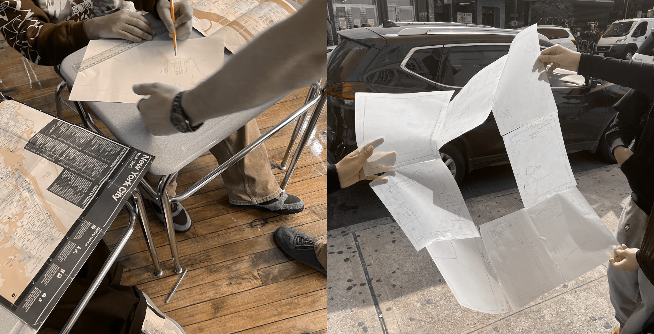
for the past month, i’ve been teaching an elective at a design focused high school in NYC on creative cartography - it’s a totally new topic to them, and lesson planning is totally new to me. and the main thing i’ve learned is that i’m just as scared of teenagers now as i used to be, when i was a teenager.
so far, we’ve made personal maps of the school, their home block, and their first big assignment - their personal map of NYC.
a few future assignments i’m trying to get a bit more creative with now that we’ve set a baseline. with inspiration from Yumi’s work above, once i’m back from vacation, we’ll get each student group to draw a map of the block, swap maps with another group, and try to navigate to another spot on the block. i’d love to take advantage of the sun before it gets too cold.
i love getting to connect with the students, ones who get to see their city in a new light, or get more comfortable with identifying locations as each week passes. i’ve learned a lot about how these students navigate their surroundings with their friends, and what their perceived world looks like.
i still get really nervous around them. i want them to like me! and getting to chat with each student about their worlds is what makes me leave the afternoon smiling. my biggest hope is to inspire even just one student, on how to leverage the medium of maps in their art and design work in the future.
that’s it! let me know if you see a cool map in the wild (or if you make one yourself)